Since a few years the vintage cycling event Eroica, which takes place every year on the 1st Sunday of October, has added a new route: the Mini Chianti. This route is for who wants to sniff the atmosphere of the event and of the beautiful Chianti region but is not really used to great distances. Another name for this route is the passeggiata valle del Chianti which means as much as a walk in the Chianti valley.
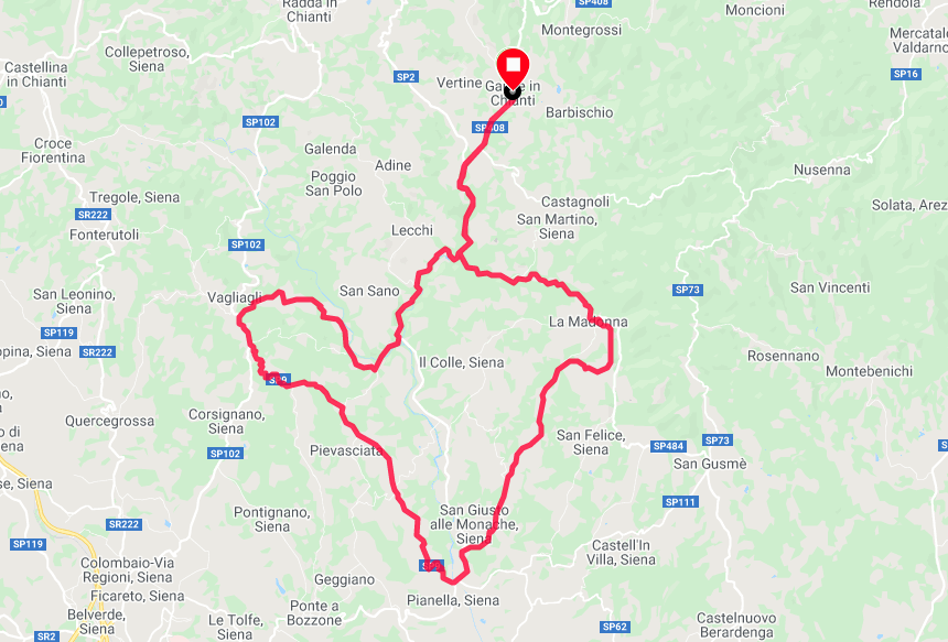
plan Mini Chianti Eroica
This mini Chianti is only 45km with a height difference of just under 700m. You do get a large part of strade bianche (unpaved roads), namely 22km.
Route info
Place of departure and arrival: Gaiole in Chianti
Distance: 46km of which 22km strade bianche
Dislevel: 682 meters
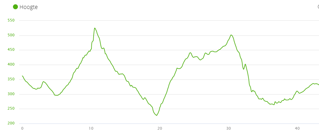
Hoogteprofiel Mini Chianti Eroica
During this route you will mostly cycle on the long distance course (209km). The start is usually between 08.00 and 09.30 and on this route there is 1 provision.
Starting place and arrival is the market square Piazza Ricasoli. From there you turn to the left and follow the signs of the Eroica where you get the first strade bianche at the height of the wine castle Castello di Brolio. Just before the gravel strip you will see on your left the Eroica Café where you can catch your breath after the climb.
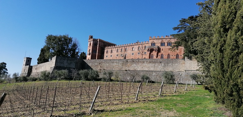
The beautiful castle Castello di Brolio
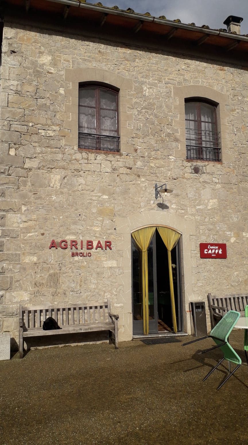
The Eroica café
At the highest point, at the height of the castle, you get a long descent, first on strade bianche but then on asphalt. At the height of Pianella you get the next gravel strip and therefore immediately the next climb. Now you are actually on the way back from the long track. Near Pievasciata you will see the entrance to the Parco delle Sculture on the left, an open-air park with numerous works of art.
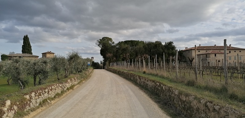
strade bianche amidst olive groves and farms
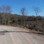
After a few hundred meters of asphalt road you get a long stretch of strade bianche, this time mainly flat. At the height of the village of Vagliagli, turn right towards Carpineto and you almost immediately get a long descent on gravel. The first part is still good to ride with a racing bike, but after only a few kilometers the road gets worse and worse and the trick is not to get a flat tire.
The road is full of protruding stones and the wheels of your bike suffer very hard. A mountain bike or gravel bike is better suited here. There is no improvement until the provincial road SP408 di Montevarchi where you turn left towards the starting point.
This is a nice ride where you get a lot of beautiful views of the vineyards, castles and olive groves. The last part strade bianche is personally not suitable for me with a racing bike.
If you want to drive the ride yourself during your stay in Tuscany, you can download the route on your cycling computer with GPS, If you also have a Garmin device then you can click on the map below, which will take you directly to the page of the ride with all information about the route, the altitude profile, ....